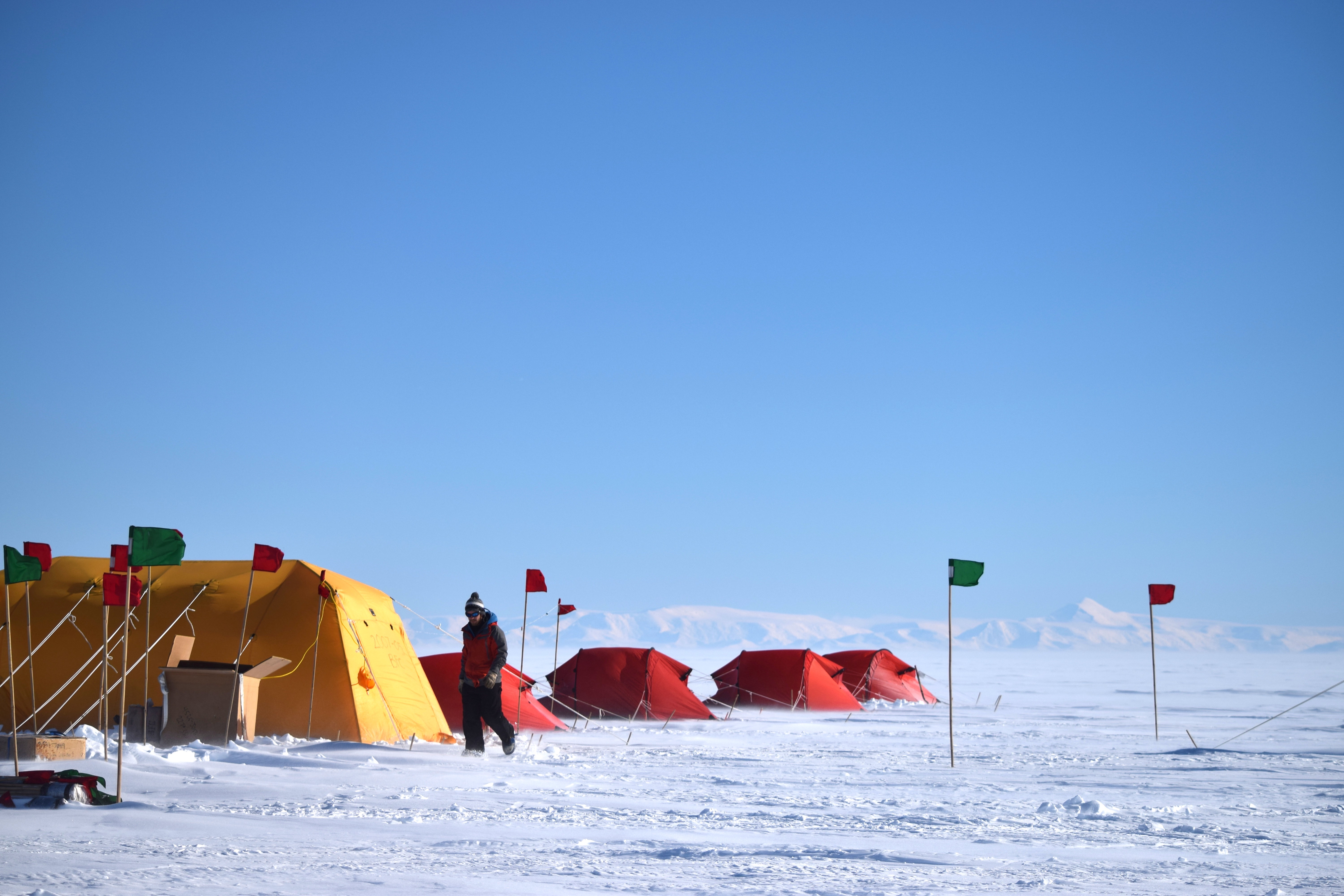
Current Projects
Our Research
Our group is motivated by the need to understand not just how the Earth’s ice masses change, but why. We focus on processes at interfaces (ice-bed, ice-ocean, and ice-air) in order to capture how Earth’s land masses interact with other components of the Earth’s climate system. We construct long, detailed records of dynamic changes of ice sheets from multi-mission remote sensing campaigns to isolate processes and help separate internal variability from long-term changes. For more detailed insight, we compliment remote sensing observations with targeted ground- and air- campaigns, including three-dimensional, high-precision GPS surveys, radio-echo sounding, electromagnetics, and other geophysics tools.
Below is a non-exhaustive list of some of the projects we are currently working on. Because Greenland and Antarctica both react to and drive the Earth’s climate system, teasing out the exact driver of change requires extensive collaboration. We work with glaciologists, engineers, oceanographers, atmospheric scientists, and geologists from around the world to develop a more holistic picture of ice-sheet change. We are always looking for new, exciting collaborations, so get in touch if you are interested in working together to investigate the Earth’s cryosphere.

Current Projects
Accelerating NASA Cryosphere and ICESat-2 science with collaborative cloud computing
Science is not composed of isolated groups of practitioners, but is rather an interconnected network of communities of practice, with members that fluidly move between them. Infrastructure for scientific research and collaboration should lean into this structure and find ways to leverage it to make science more productive and inclusive. NASA (along with many other scientific entities) has started to adopt practices consistent with this natural structure of contemporary science. Communities such as Project Jupyter and Pangeo have started to create a model for the inclusive, interconnected, and data-intensive practices of the future through cloud-based JupyterHub workflows. However, substantial barriers exist for individual users to make the transition from their local systems to the cloud to accomplish research goals: cloud cost opacity, deployment complexity, and a general lack of community awareness and knowledge, among others. We can overcome these barriers by building upon the existing cloud-workflow model and creating infrastructure that allows researchers to fluidly move their workflows wherever they can do their best work.
We have two projects, led by postdoctoral scholar Dr. Tasha Snow and visiting PhD student Joanna Millstein, to establish a curated interactive computing platform and develop community expertise in using these platforms with the NASA ICESat-2 Science Team and the larger NASA Cryospheric Science Community during the NASA Year of Open Science in 2023. Specifically, we will (1) provide cloud and community expert-led training workshops at multiple community venues (including ICESat-2 Science Team meetings, the Future of Greenland ice Sheet Science (FOGSS) Workshop, the West Antarctic Ice Sheet (WAIS) Workshop, and the American Geophysical Unioin Fall Meeting), and (2) build new open-source tools that facilitate the growth of multi-community infrastructure. To accomplish these goals, we will partner with the International Interactive Computing Collaboration (2i2c) team, who will operate and develop the cloud-infrastructure—to manage and operate community-specific infrastructure, developing and improving the open source tools behind it, and guiding these communities in their use of these tools.
NSF CAREER: Long-term dynamics of Whillans Ice Stream deceleration
Antarctic ice streams and outlet glaciers are the primary conduits of glacier ice from the interior of the continent to the ocean, where net ice loss contributes to global sea-level rise. Any process that speeds up or slows down the rate at which these ice streams move can appreciably impact the balance between ice gain and loss in Antarctica, with important implications for coastal communities worldwide. Processes that can lead to ice-stream acceleration are frequently studied, whereas ice-stream stagnation, which most recently occurred in Antarctica about 180 years ago, is studied less often. Our work leverages two decades of existing data from field experiments in Antarctica on Whillans Ice Stream, West Antarctica—a decelerating ice stream. We are re-processing these geodetic and seismic datasets from five different NSF-funded projects using modern geophysical methods to build long time-series of observations that provide insight into ice-sheet processes and test hypotheses about how stagnation occurs. In parallel, we are leveraging existing experiential field data to develop unique immersive learning modules to provide an accessible mechanism for the next generation of STEM students to experience Antarctic field work. Finally, this CAREER award will support a new pathway for a diverse cohort of researchers in the glaciology community by establishing and hosting annual regional Colorado Glaciology meetings that will connect community college educators and local glaciology researchers to exchange ideas, develop collaborations, and advertise opportunities.
Funding Program: NSF CAREER Program
Start Date: 1 August 2022
End Date: 13 July 2027
Quantifying bias and uncertainty sources between laser and radar retrievals of surface topography over cryospheric targets
Accurate quantification of the primary observables identified by the Surface Topography and Vegetation (STV) working group bare surface land topography, ice topography, vegetation structure, shallow water bathymetry, and snow depth requires geodetic measurements with sub-meter vertical resolution and sub-weekly temporal repeat-sampling. A multi-sensor fusion approach combining lidar, radar, and stereophotogrammetry from both orbital and suborbital platforms will likely be necessary to achieve these resolution requirements. However, a thorough investigation of the biases and uncertainties inherent to each of these geodetic measurements, as well as how these biases and uncertainties might compound in a multi-sensor fusion approach, is needed before any such multi-sensor framework can be developed and optimized.
Former Mines Glaciology Laboratory postdoctoral scholar Dr. Roger Michaelides leads this project where our groups collaborate to investigate the sources of measurement bias and uncertainty in orbital laser altimetry, radar altimetry, and interferometric synthetic aperture radar (InSAR) measurements over ice sheet surfaces and periglacial land surfaces. These two surface types are subject to the time- and space-varying surface dielectric properties of snow, ice, and surface water, and subjected to seasonal and interannual geomorphic processes that can reshape surface topography (such as sub- or supra-glacial lake drainage at ice sheet boundaries and permafrost thaw and thermokarst initiation in periglacial regions), all of which complicate the error inherent in and interpretation of surface height measurements. We have three cross-cutting objectives:
-
- Characterize and reduce sources of uncertainty and biases in laser altimetry, radar altimetry, and InSAR measurements over ice sheet surfaces and periglacial land surfaces.
- Quantify the effect of these uncertainties on vertical and rate of change accuracies for both cryospheric and solid-earth/hydrologic targets.
- Develop and test novel multi-sensor data fusion methods and algorithms that leverage complementary geodetic measurements for improved topographic products and temporal-repeat measurements.
Funding Program: NASA Decadal Survey Incubation Program Science
Start Date: 15 June 2022
End Date: 14 June 2025
Collaborating Institutions: Washington University, St. Louis
Seeds of Change: Investigating the Impact of Antarctic Basal Channel and Persistent Polynya Co-Evolution on Ice Shelf Stability
Ice shelves and their tributary glaciers that drain Antarctica account for almost the entirety of net mass loss from the Antarctic Ice Sheet, the source of the greatest uncertainty in 21st-century sea-level rise projections. Nearly half of the glacier ice that reaches the ocean to form floating ice shelves is lost to basal melting by the ocean. This melting varies substantially in time and space as a result of complex climate, ocean, and ice interactions, making projections of future ice loss difficult. In particular, enhanced localized basal melt rates can incise ice-shelf basal channels that may structurally weaken ice shelves. Many of these channels convey water sourced from the upstream locations where the channels form to the edge of the ice shelf. This outflow often includes residually warm ocean water with enough heat to maintain local sea icefree ocean conditions seasonally or year-round for small areas near the ice front, known as persistent polynyas. The water in these polynyas represents a mixture between the ocean water mass that initiated basal melt and the melt content entrained as the water exits the ice shelf cavity.
In this project led by postdoctoral scholar Dr. Tasha Snow, we will use optical and thermal infrared imagery from the Landsat 7 through 9, Aqua and Terra, Sentinel-2, and Sentinel-3A/B instrumentation in a multi-sensor and multi-modal data fusion investigation that will assess the characteristics variability of the persistent polynya ice-ocean features in Antarctica. Data from field observations and ICESat-2 laser altimetry will be examined using modern machine learning approaches and cloud-based, open-sourced workflows. The proposed work is organized around three specific goals:
-
- Automate persistent polynya detection and characterization for community use;
- Optimize Landsat, MODIS, and Sentinel-3 SST retrievals to build year-round upper ocean temperature records for multiple Antarctic basal channel outflows; and
- Assess ice shelf and water outflow co-evolution using a data fusion framework for deriving ice shelf and ocean parameters.
Funding Program: NASA Cryospheric Science
Start Date: 1 February 2022
End Date: 31 January 2025
Collaborating Institutions: University of Colorado Boulder, University of Manitoba, University of St Andrews, University of Berkeley
Four decades of Ross Ice Shelf subsurface change with historical and modern radar sounding data
Ice shelves play a critical role in restricting the seaward flow of grounded glacier ice by providing buttressing at their bases and sides. Processes that affect the long-term stability of ice shelves can therefore influence the future contribution of the Antarctic Ice Sheet to global sea-level rise. The Ross Ice Shelf is the largest ice shelf on Earth, and it buttresses massive areas of West and East Antarctica. With collaborators at Georgia Tech and Stanford University, we examine more than four decades of historical and modern airborne radar sounding observations of Ross Ice Shelf (spanning 1971 to 2017) to investigate ice-shelf changes on decadal timescales. Our collaborative team processes, calibrates, and analyzes radar data collected during 1971-79 field campaigns and compare them against modern observations collected between 2011-17 in order to better quantify the evolution of the largest ice shelf on Earth.
Funding Program: NSF Antarctic Science
Start Date: 15 August 2021
End Date: 14 August 2024
Collaborating Institutions: Georgia Tech (lead), Stanford University
Leveraging ICESat-2 altimetry for Antarctic subglacial lake identification, evolution, and basal properties
As part of NASA’s ICESat-2 mission Science Team, we help guide this NASA Earth Science flagship mission toward its mission goals and use ICESat-2 laser atlimetry data, in concert with data from other remote and in situ platforms, to extend and refine our multidecadal time series of dynamic hydrology systems beneath Antarctica. In particular, we work to leverage the increased spatial resolution of ICESat-2 data compared to previous altimeters to better interpret past datasets, quantify our confidence in the drivers of dynamic height anomalies on ice sheets, and identify new areas of interest across Antarctica.
Funding Program: NASA Studies with ICESat-2
Start Date: 1 May 2021
End Date: 30 April 2024
Observing snow and snow processes on ice sheets
The life cycle of snow is one of the most critical unknowns of the polar climate system. In situ observations for constraining model physics and validating coupled atmosphere-ice sheet models are sparse, especially in Antarctica where surface mass balance amounts to approximately 2600 Gt of mass input per year. We have two projects, funded through NASA GNSS Research and NASA Interdisciplinary Research in Earth Science, to try to fill this urgent gap in our understanding of Earth’s atmosphere-ice-ocean interactions. Our GNSS Research project, in collaboration with Dr. Brooke Medley at NASA Goddard Space Flight Center, will produce high resolution surface height time series in West Antarctica using GNSS reflectometry techniques to optimize and validate firn densification models. We also will investigate the space-time trade offs inherent in this method to identify the science questions this method can answer.
Dr. Brooke Medley leads our NASA Interdisciplinary Research in Earth Science Project, where a collaborative team from NASA, University of Oregon, University of Washington, University of Colorado Boulder will produce observationally constrained models of all stages of the life cycle of snow over ice sheets. Specifically, we employ observations of snowfall and rainfall rates (CloudSat), surface height change (ICESat, ICESat-2, GNSS reflectometry, AWS), snow thickness (Operation IceBridge snow radar), blowing snow fluxes (ICESat, ICESat-2), albedo and timing of bare ice exposure (MODIS), mass change (GRACE, GRACE-FO), and microwave brightness temperatures (SSM/I, SSM/IS, AMSR-E, AMSR2). Individually, these observations provide mediocre constraints on snow evolution since they target a specific stage of the life cycle; in conjunction, they provide independent controls on the entire system.
Funding Program: NASA GNSS Research
Start Date: 1 September 2020
End Date: 31 August 2023
Collaborating Institutions: NASA Goddard Space Flight Center
Funding Program: NASA Interdisciplinary Research in Earth Science
Start Date: 1 September, 2020
End Date: 31 August 2023
Collaborating Institutions: NASA Goddard Space Flight Center (lead), University of Oregon, University of Washington, University of Colorado Boulder
Pingo SubTerranean Aquifer Reconnaissance and Reconstruction (Pingo STARR)
Mars, Ceres, and the Earth have abundant reserves of ground ice. On Earth, ice-cored mounds known as pingos are important indicators of extant and extinct near-surface groundwater systems, hydrologic properties, and local climate. Spacecraft observations of Mars and Ceres have revealed a variety of deca- to kilometer scale hills with morphological similarities to terrestrial pingos in ice-rich environments. With our colleagues at University of Alaska Anchorage, Cornell University, Planetary Science Institute, and University of Toronto, PingoSTARR will advance human and lander scale geophysical techniques specifically tailored to detect, characterize, and investigate the cryohydrology and genesis of possible pingo-like features on Earth, Mars, and Ceres. This systems-level field campaign will be the most comprehensive to date for any terrestrial pingos, and the first dedicated analysis of pingos from a planetary science perspective. Our science and technology objectives will provide valuable insight into detecting and characterizing ground-ice and -water systems on Mars and Ceres.
Funding Program: NASA Planetary Science and Technology from Analog Research
Start Date: 1 July, 2020
End Date: 30 June 2024
Collaborating Institutions: University of Alaska Anchorage, Cornell University (lead), Planetary Science Institute
West Antarctica Ice Sheet (WAIS) Workshop
The WAIS Workshop has been held annually for the past 25 years, providing a venue for transdisciplinary scientific exchange on the state and behavior of the West Antarctic Ice Sheet, processes that influence its changing behavior, and projections of its future mass balance and sea-level contribution. In collaboration with colleagues from University of Virginia, University of Florida, University of Minnesota, University of Washington, and NASA Goddard Space Flight Center, we are funded by the National Science Foundation and NASA to organize and host the 2019, 2020, 2021, and 2022 WAIS Workshop and archive these conferences for free public viewing after the conference concludes. Check out our YouTube Playlist tab to view the latest West Antarctic science!
Funding Program: NASA Cryospheric Science and NSF Antarctic Science
Start Date: 1 August 2019
End Date: 31 July 2023
Collaborating Institutions: University of Washington, University of Minnesota, University of Florida, University of Virginia, NASA Goddard Space Flight Center
Past Projects
Subglacial Antarctic Lakes Scientific Access (SALSA)
We know more about Mars than we know about Antarctica’s subglacial environment, but new information about its nature is changing the way we view the continent. The Subglacial Antarctic Lakes Scientific Access (SALSA) project is uncovering new knowledge about this newly explored biome through an integrative study of physical glaciology, subglacial geobiology, water column and sedimentary organic carbon, and geobiological processes in a West Antarctic subglacial lake.
Mines Glaciology works within the larger SALSA umbrella to understanding the coupled ice-water dynamics that govern dynamic subglacial hydrology in Antarctica. We use long-term continuous GPS stations, airborne radar, and satellite radar and laser altimetry to piece together the history of water flow beneath the Mercer and Whillans ice streams and work with our SALSA colleagues to quantify the impact of this rapidly changing water system on sediment transport and geomicrobiology. Read more about our long-term GPS network here.
In January 2019, the SALSA Project set up a field camp of nearly 50 scientists, drillers, and support staff and drilled 3,500 feet into the ice to sample from Mercer Subglacial Lake. After 10 days of sampling, Mines Glaciology installed a permanent fiber-optic cable in the ice column and subglacial lake for distributed temperature sensing, representing the first of hopefully many long-term subglacial observatories in Antarctica.
Follow SALSA on our Blog, Instagram, Twitter, or Facebook. Click here to view news stories highlighting SALSA’s work.
SALSA EM: Mapping subglacial groundwater in Antarctica
Standard geophysical surveying techniques used in glaciology to image subglacial water (radio-echo sounding and active-source seismology) are not directly sensitive to water content. Ground-based electromagnetic (EM) methods are sensitive to water content and, although they are well-established for high-precision mapping of hydrology in other geological environments, they have not been applied on ice sheets. SALSA EM adapts both passive- and active-source EM techniques to glaciological questions into order to quantify the three-dimensional structure of subglacial water beneath an ice stream.
During November 2018 to January 2019 we carried out an extensive geophysical survey on the Whillans Ice Stream in West Antarctica. Our survey is the first to use magnetotelluric (MT) imaging to map subglacial groundwater water beneath an ice stream. We collected a total of 44 passive MT stations, as well as several active-source electromagnetic (EM) stations using a large loop transmitter system. With these data, we will study the distribution of groundwater at the base of the ice stream at both the grounding line where the ice stream flows into Ross Ice Shelf and at Whillans Subglacial Lake. Our project is in collaboration with Kerry Key (Lamont Doherty Earth Observatory) Helen Fricker (Scripps Institution of Oceanography, UC San Diego).
Many thanks to Phoenix Geophysics for lending us four MTU-5C ultra-wideband magnetotelluric systems and to Phil Wannamaker for his electric field preamp systems.
Read more about our field experience here, or read about some of the results in Gustafson et al. (2022) or Winnie Chu’s fantastic perspective on our work.
Funding Program: NSF Antarctic Science
Start Date: 1 December 2017
End Date: 30 November 2022
Collaborating Institutions: Scripps Institution of Oceanography (lead), Columbia University
NASA Operation IceBridge
- supported OIB deployments through mission planning and lidar error assessments;
- developed a new technique for deriving high-precision time series from OIB swath laser altimetry;
- leveraged OIB to investigate Antarctic subglacial lake processes;
- explored decadal-scale temporal variability of ice-shelf basal channels; and
- quantified the structure of the Ross Ice Shelf front for insight into ice-ocean interaction.
Funding Program: NASA Operation IceBridge Science Team
Start Date: 1 April 2019
End Date: 31 March 2021
Collaborating Institutions: Scripps Institution of Oceanography (lead)